Project Phase
Project Summary
The primary objective of the Granite Reef Watershed Improvement Project is to eliminate the risk of structural flooding, eliminate the Federal Emergency Management Agency (FEMA) floodplain along Granite Reef Wash, and reduce street and yard flooding.
Project Information
Budget: $16,800,000
Sponsoring Division: Stormwater & Floodplain Management
Funding Source: Bonded
Additional Funding Sources: Bond 2000, General Fund, CIP Stormwater Utility Bill, in cooperation with Flood Control District and Salt River-Pima Indian Community
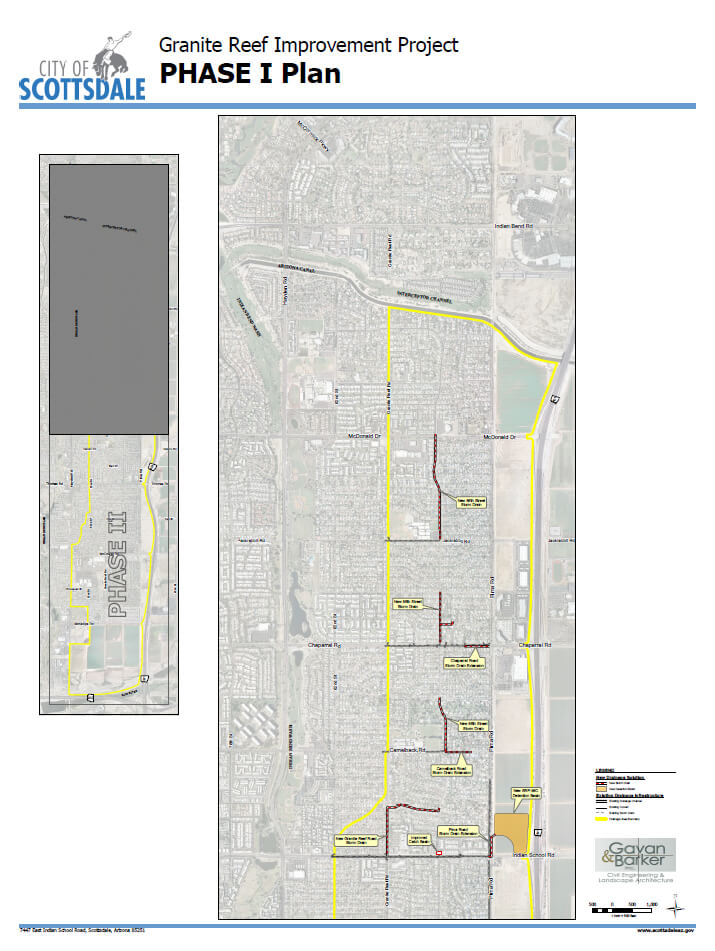
Project Location: The Improvements will occur within the boundaries of Pima Road, Indian School Road, Granite Reef Road and the Arizona Canal.
Project Area
Planned Drainage Improvements
NORTH Improvements (Phase 1) - COMPLETE
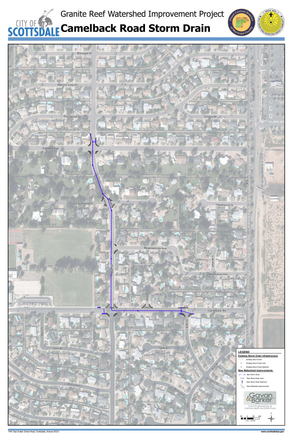
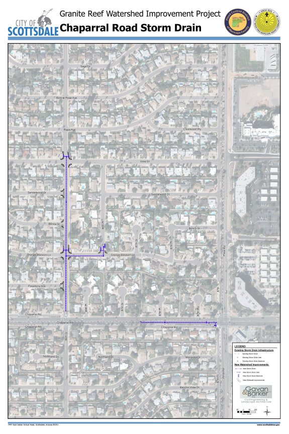
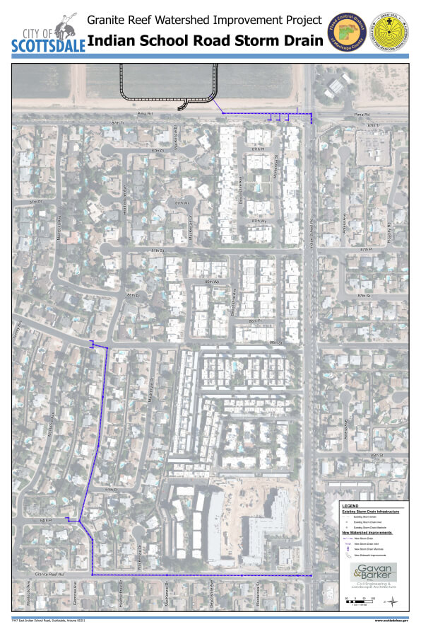
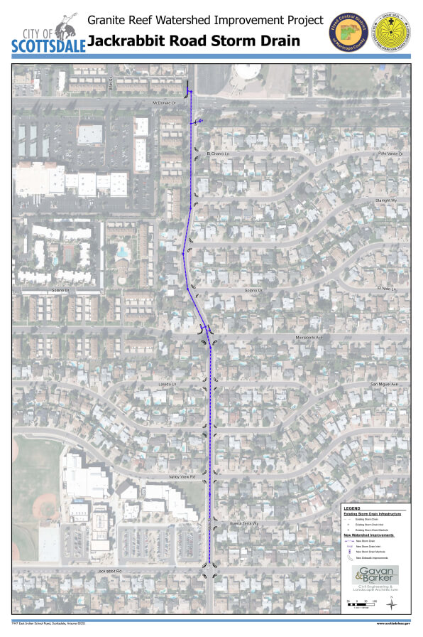
Construction of the Phase 1, North Area Improvements took place between June 2017 and June 2021. Construction is now complete on new storm drain laterals that connect to the existing storm drains on Jackrabbit Road, Chaparral Road and Camelback Road. The new laterals will discharge more flow to the existing storm drains allowing more runoff to be diverted to Indian Bend Wash, so it doesn’t flow south, resulting in flooding problems downstream. The proposed storm drain laterals will control all the 100-year runoff north of Indian School Road.SOUTH Improvements (Phase 2)
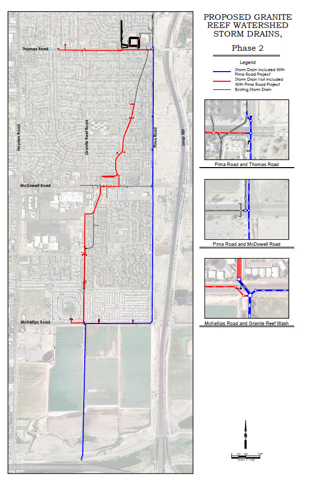
The SOUTH area implementation plan includes new drainage improvements south of Indian School Road that, which, together with the North area improvements, will hopefully eliminate the FEMA floodplain along the Granite Reef Wash. The SOUTH area improvements will be built in two segments. The first portion will be built with the widening of Pima Road (Phase 2A), the remainder of the storm drain improvements will follow with the construction of Granite Reef South (Phase 2B).
These improvements include:
- A storm drain in Thomas Road between 82nd Street and Pima Road (2A Pima Road)
- A storm drain in McKellips Road between 82nd Street and Pima Road (2A Pima Road)
- A storm drain in the Granite Reef Wash alignment from McKellips Road to the Salt River. (2B Granite Reef)
- A stormwater detention basin in Pima Park (2B Granite Reef)
- A storm drain in Pima Road from Thomas Road to McKellips Road (2B Granite Reef)
- Granite Reef Channel improvements both upstream and downstream of McDowell Road (2B Granite Reef)
Pima Road Improvements
A series of improvements are planned for Pima Road from McDowell Road to the Salt River Pima – Maricopa Indian Community’s (SRP-MIC) north boundary near 90th Street and Via Linda. The improvements are based on a concept report that was developed in 2009 and will include a portion of the Granite Reef Watershed Storm Drain Improvements.
The project includes widening Pima Road, intersection improvements at Talking Stick Way, Via de Ventura, and Via Linda/90th Street, as well as landscape improvements between Via de Ventura and SR Loop 202 Freeway. The project will increase safety, mitigate flooding impacts, add traffic capacity and improve multimodal and pedestrian features, and add consistency to the overall corridor.
Pima Road is co-owned by SRP-MIC and City of Scottsdale, and SRP-MIC is the lead agency completing this project in partnership with the City and other funding partners. Other funding partners include the Flood Control District of Maricopa County (FCDMC) and the Maricopa Association of Governments (MAG).
New Hydrologic and Hydraulic Analysis & Application to FEMA for Floodplain Management
Budget (Estimate): $24.3 M – Project will be funded as IGA’s are finalized.
Sponsoring Division: Stormwater & Floodplain Mgmt
Funding Source: CIP Stormwater Utility Bill, Salt River Pima-Maricopa Indian Community, and Flood Control District of Maricopa County and Federal Highway Administration (as part of Pima Road Improvements).
Project Location: Pima Road between Thomas Road to McKellips Road and 84th Place from McKellips Road to the Salt River.
Additional Information: This phase of design and construction is being lead by the Salt River Pima-Maricopa Indian Community as part of the improvements for Pima Road, Via Linda Road to McDowell Road.
Budget (Estimate): $24.9M Funding is pending. We will have to create a new CIP project.
Sponsoring Division: Stormwater & Floodplain Mgmt
Funding Source: CIP Stormwater Utility Bill, Salt River Pima-Maricopa Indian Community, and Flood Control District of Maricopa County.
Project Location: The Improvements will occur within the boundaries of Thomas Road and McKellips Road within 87th Street and Granite Reef Road.
Additional Information: This phase of design and construction is being lead by the City of Scottsdale. Upon completion, a Letter of Map Revision will be submitted to FEMA for adjustments to the floodplain.
