Introduction
Scottsdale's goal is to develop and maintain a citywide interconnecting network of trails to provide valuable recreation and transportation opportunities for residents and visitors. Trails function as transportation links between schools, residential areas, parks, places of employment, shopping areas and other areas of interest. Trails also provide hikers, walkers, joggers, equestrians, mountain bicyclists and people with disabilities opportunities to improve health and fitness, spend time with family and friends, enjoy the natural environment and escape the stress of everyday life. Trails are an integral part of Scottsdale's transportation infrastructure and a fundamental component to an enhanced quality of life for the community.
Scottsdale has been preparing plans and building public trails for the last five decades. In 2004, after an extensive public involvement process, the Scottsdale Trails Master Plan: On the Right Trail was officially adopted by City Council. In 2007, the Transportation Department assumed responsibility for public trails outside Scottsdale's McDowell Sonoran Preserve and kept the commitment to include trails within an element of the first Transportation Master Plan update which occurred in 2016. This 2022 Transportation Action Plan Trail Element is a culmination of the past planning efforts and aligned with approved policies, network planning and design standards.
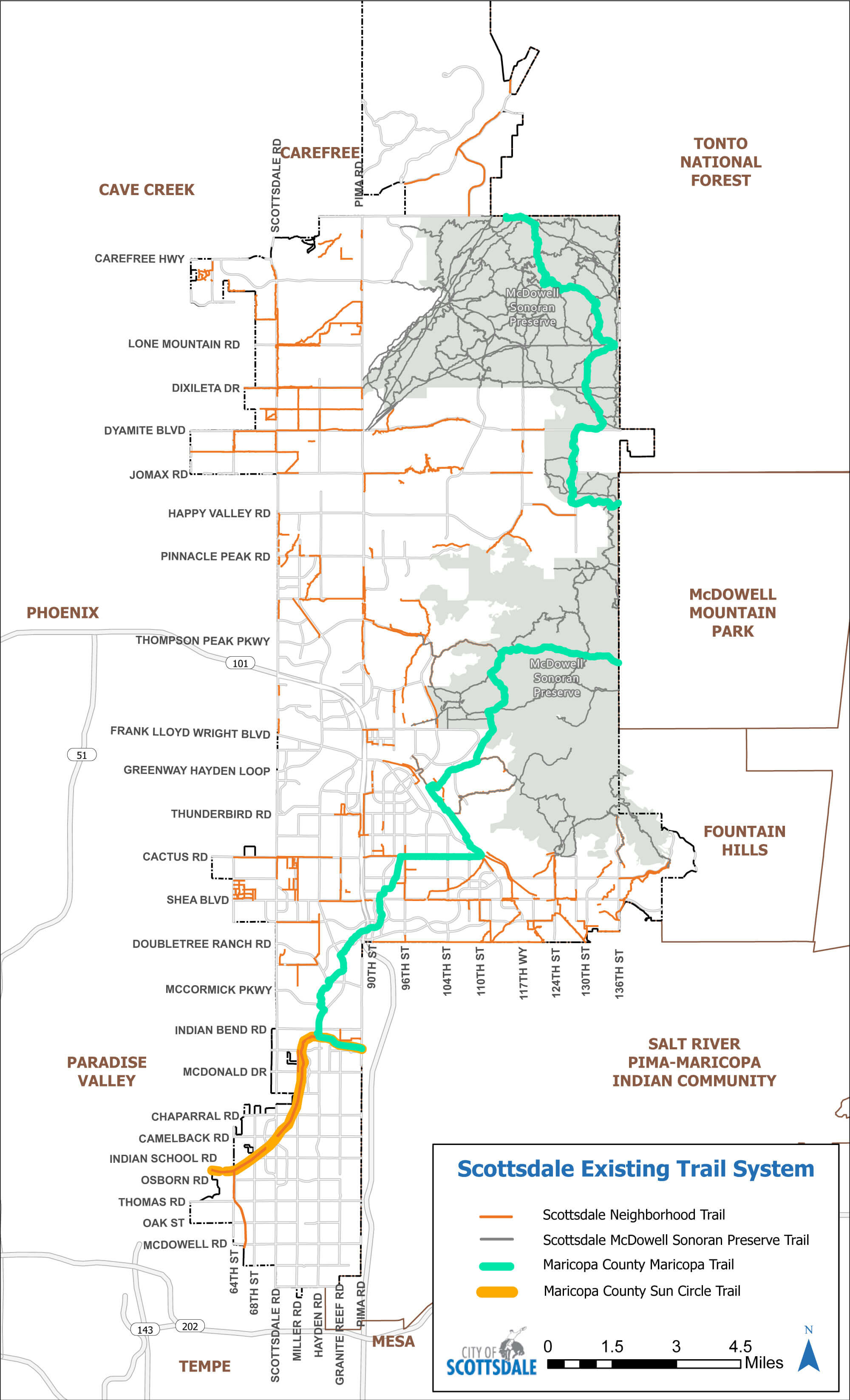
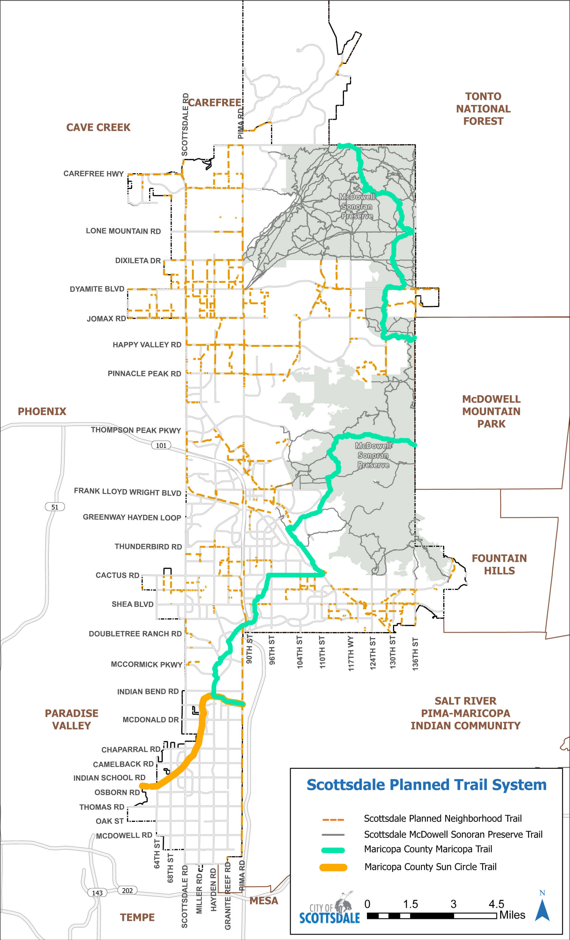
Today Scottsdale has 150 miles of trails that are woven throughout neighborhoods within the city. This transportation action plan documents 140 miles of planned trails that will complete the buildout of the network over future years (see Figure TR-1)
Goals
- Develop an effective and connected multi-modal transportation system with the integration of trails.
- Actively work with neighborhoods, neighborhood associations and adjacent jurisdictions to coordinate all planned and existing links to the trail network.
- Provide improved trail connectivity within neighborhoods and access to schools and parks.
- Maintain Scottsdale's high aesthetic values and environmental standards when planning and constructing trails.
- Educate the public about easements and maintenance responsibilities associated with the trail network.
Policies
- Trail Access: Purchase public access if necessary, align trails where there is available access, and avoid condemnation when possible.
- Trail Obstruction: Coordinate with landowners regarding obstruction removal and require trail realignment by landowner if necessary.
- New Trails Crossing Undeveloped Land: Identify existing rights of way along parcel boundaries to build temporary trail if necessary and require developers to dedicate a public nonmotorized access easement and build trail if applicable.
- Trail Easement Abandonment: Trail easement abandonment requests will require a Trail Impact Analysis.
Trail Classifications and Standards
Trail widths vary depending on the purpose and environment. A trail could follow a major roadway, weave through a neighborhood or traverse rugged terrain. Therefore, trail classifications and standards were established to assist in providing the right trail for the right place.
Scottsdale has four types of trails: primary trails, secondary trails, neighborhood trails and minimally improved/rugged trails. Each classification has unique standards that align the trail with its environment. For all trail classifications, motorized vehicles are only permitted for maintenance and emergency purposes and where trail widths allow.
Primary Trails
Primary Trails provide both transportation and recreation links between residential areas, schools, businesses, parks, places of employment and other areas of significant community activity. Primary Trails are used by hikers, equestrians and bicyclists and typically have the most use of the trail types. The trail surface may be comprised of either native soil or decomposed granite. Urban Trails have the greatest width of all trail classifications and therefore accommodate leisurely side-by-side travel and easy passing for multiple user types. These trails are typically located within areas of relatively level topography.
Secondary Trails
Secondary Trails provide alternative transportation and recreation links through areas such as desert washes, scenic corridors, vista corridors and other desert open space areas. Secondary Trails are also used by hikers, equestrians and bicyclists, but typically experience a lower level of use than Primary Trails. Secondary Trails are narrower than Primary Trails and occasionally users must travel single file. Secondary Trails are typically located within areas of level to moderate topography.
Neighborhood Local Trails
Neighborhood Local Trails provide access in and around neighborhood areas and provide connections to Primary and Secondary Trails. Neighborhood Local Trails typically act as “feeder” trails to the regional trail network and may provide close-to-home recreational opportunities. Hikers, equestrians and bicyclists also use Neighborhood Local Trails, and in more rural areas, they sometimes serve as “sidewalks.”
Minimally Improved/Rugged Trails
Minimally Improved/Rugged Trails are built as far away from traffic as possible and designed for equestrians, hikers, runners and mountain bikers. Minimally Improved/Rugged Trails are constructed in areas where other disability-accessible trail options are available or where the construction of an accessible trail will alter substantially the character of the surrounding area, impact culturally significant areas or be difficult to construct because of the terrain, such as in washes.
Trail standards such as slope, width and vegetation clearance are associated with each trail classification. These standards can be found in the Design Standards and Policies Manual (2018).
Trail Corridors and Regional Connectivity
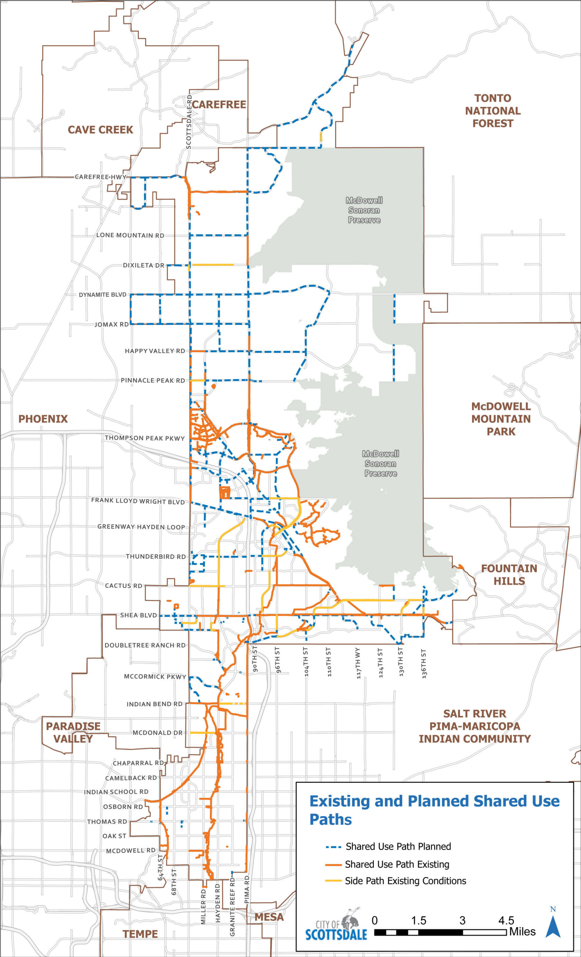
Scottsdale has a robust trail system throughout the city with 220 miles of trails in Scottsdale's McDowell Sonoran Preserve and 150 miles of trails in the neighborhood trail system. Main trail corridors, including the Arizona Canal, Crosscut Canal, Central Arizona Project Aqueduct and Arizona Public Service (APS) Powerline, provide gateways to the regional trail system. An extensive regional trail system, including the Sun Circle Trail and Maricopa Trail, winds through Scottsdale and aligns with existing trails located along the main trail corridors, the Indian Bend Wash Path System and Scottsdale's neighborhood trail system (see Figure TR-2).
Trail Prioritization
Neighborhood trails are constructed using a yearly capital project. The first priorities for trail construction are the completion of planned connections to the McDowell Sonoran Preserve at designated access points and planned Neighborhood Trails in rural areas that do not have sidewalks.
Specific trail segments and improvements are further prioritized by the following criteria:
- Corrects safety issue on an existing trail or with a new trail
- Completes a gap or unfinished project resulting in a significant, usable and continuous trail
- Completes the final unfinished segment in an existing trail
- Connects a trail to another trail
- Improves access to a neighborhood, community, preserve or regional trail destination
- Constructs a trail which meets the desired design guidelines without special conditions that would increase the construction costs
- Builds a trail in an area with high potential use due to the surrounding character area and/or land uses
Adjustments to Planned Network
During the development of the Transportation Action Plan, the planned trail system was reviewed to identify segments that:
- Lack connectivity,
- Are prone to network redundancy,
- Are infeasible to construct due to terrain and/or lack sufficient public rights-of-way or easements.
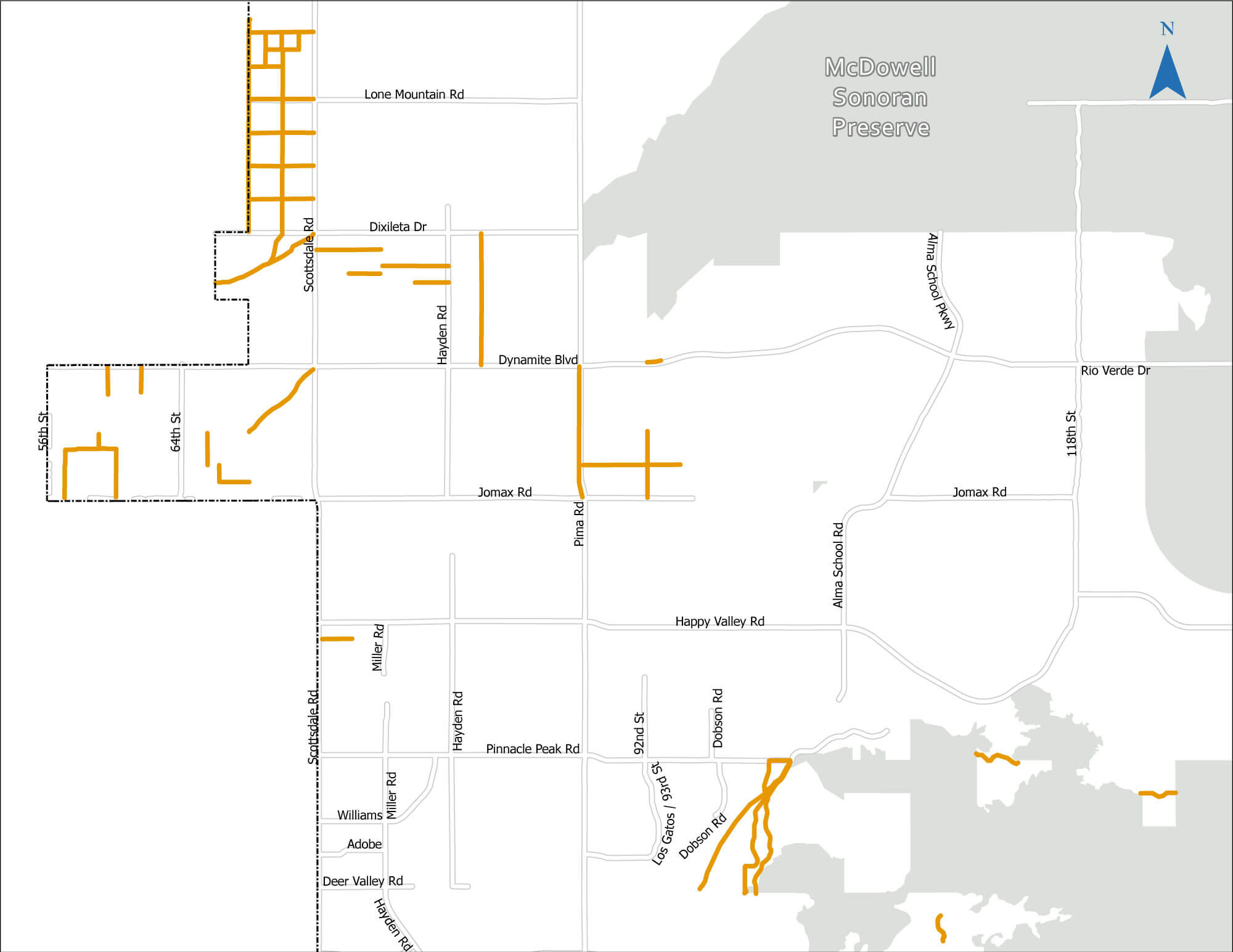
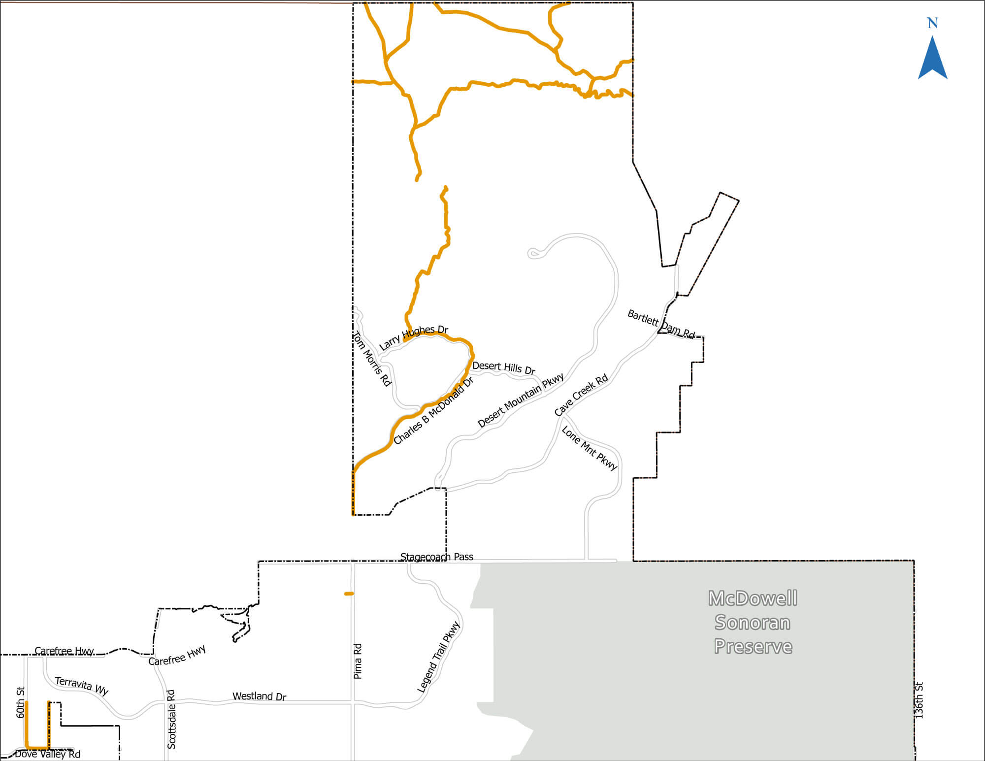
In this effort, 48 miles of planned trails were removed from the planned network of 188 miles, leaving 140 miles of planned trails. Any existing public easements in the removed segments will be retained.
Additionally, the Transportation Action Plan prioritizes completing the remaining connections to Scottsdale's McDowell Sonoran Preserve and filling in gaps within the neighborhood trail systems.
Scottsdale will continue to add to the robust network of trails available to residents and visitors. Most importantly, Scottsdale will continue to conduct inventories of the existing neighborhood trail system and make improvements to trails in need of repair. Scottsdale will also continue to educate residents and homeowner associations on their responsibility to maintain trails adjacent to their homes and communities.
Figure TR-3 depicts the planned trail network outside of the Scottsdale's McDowell Sonoran Preserve including network adjustments.
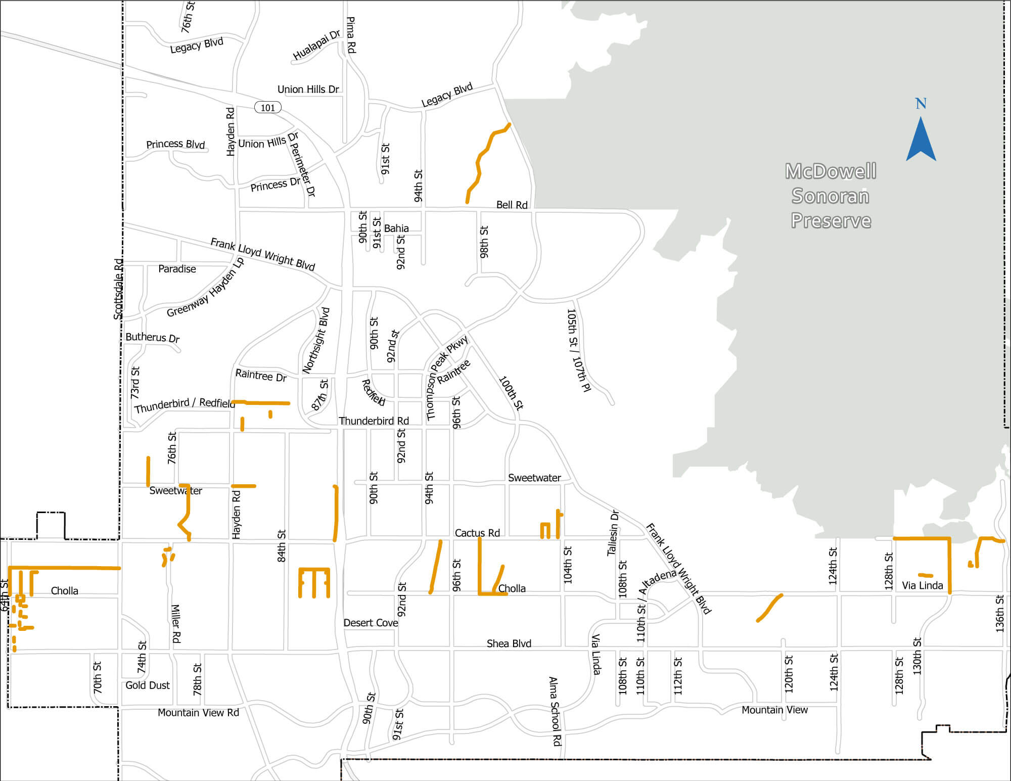
Planned Trail Segments Removed from the Network
The following figures provide the locations of the planned trail segments removed from the network.
Performance Measures
- Mileage of completed trails per year
- Mileage of rehabilitated trails per year
- Percent of planned trail network constructed per year
- Percent of population within ¼ mile network distance to trail
Last Updated: May 16, 2024
